Field notes: the morning the damage grade map rewrote our assignments twice
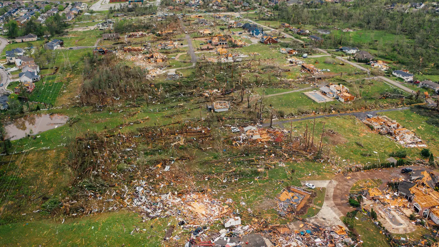
6:40 a.m., second cup of coffee, and the whiteboard already had three zones circled in red marker from the overnight storm reports. Nothing unusual there. Every event starts the same way: a handful of 911 calls, a few self-reported claims trickling in through the portal, somebody's cousin posting a video of a carport folding like a lawn chair. You build your first-wave list off that, because you have to build it off something.
By 9:15 the list was wrong, and I don't mean a little wrong.
We'd staged six adjusters out of the regional office expecting the hardest hits to run along the river corridor, based on the path and the wind reports from the airport sensor. That's the usual read: funnel the wind, follow the corridor, send people where the physics says it should be worst. Instead the damage grade came back showing a cluster of severe roof scores two miles east of where we'd pointed everyone, in a subdivision that doesn't even show up on the standard wind-swath overlay because it sits just off the modeled track.
Turns out a line of straight-line gusts had skipped the corridor entirely and worked over that subdivision's roofline like a belt sander. Nobody had called it in yet. No photos, no claims, nothing. Just a grid of buildings sitting there with severe grades on them, waiting.
So we pulled two adjusters off the river zone and redirected them before they'd even left the parking lot. First rewrite of the morning.
The second one happened around 11, after a field supervisor radioed in from a strip mall we'd graded moderate. He was standing in the parking lot looking at a row of units that, from the ground, looked like total losses on three of the six bays. The grading had called it moderate based on the roof signature, and from the air it probably was moderate on the structure itself. What the imagery couldn't see was that the HVAC units for half the mall were mounted on that roof and had been stripped clean off their curbs.
Moderate structural damage, severe business-interruption exposure. A per-building grade reads the roof, not the equipment bolted to it, which is exactly the limit you plan around rather than fight. We bumped that strip mall up the queue anyway, because we had a piece of information the grade couldn't have.
That's the part of this job nobody explains to new hires: the map sets your look order and hands you a starting point, nothing more. The value isn't that it's never going to surprise you on the ground. It's that it stops you from spending the first three days of an event guessing at priority order off whoever happened to call in loudest, which used to be exactly how this worked. I've run events where the squeaky-wheel claims got a truck on day one and the actual worst block sat untouched until day four because nobody there had cell service to call it in.
By lunch we'd reshuffled the board twice, reassigned four adjusters, and still had every truck moving toward something instead of circling a zone waiting for better information to show up. That's the whole game in the first 72 hours: keep the trucks moving toward the worst roofs instead of the loudest phones. We're pulling the per-building damage grade for the footprint straight off the imagery now, within days of the event instead of waiting on drive-bys to tell us what we already should have known that morning.
None of this replaces the field supervisor standing in a parking lot noticing something a satellite can't. It just means he's standing in the right parking lot to begin with.
If your morning board looks like mine did at 6:40, it might be worth seeing what Windstorm Damage puts on it instead.