How to tell wind damage from pre-existing roof wear in satellite imagery
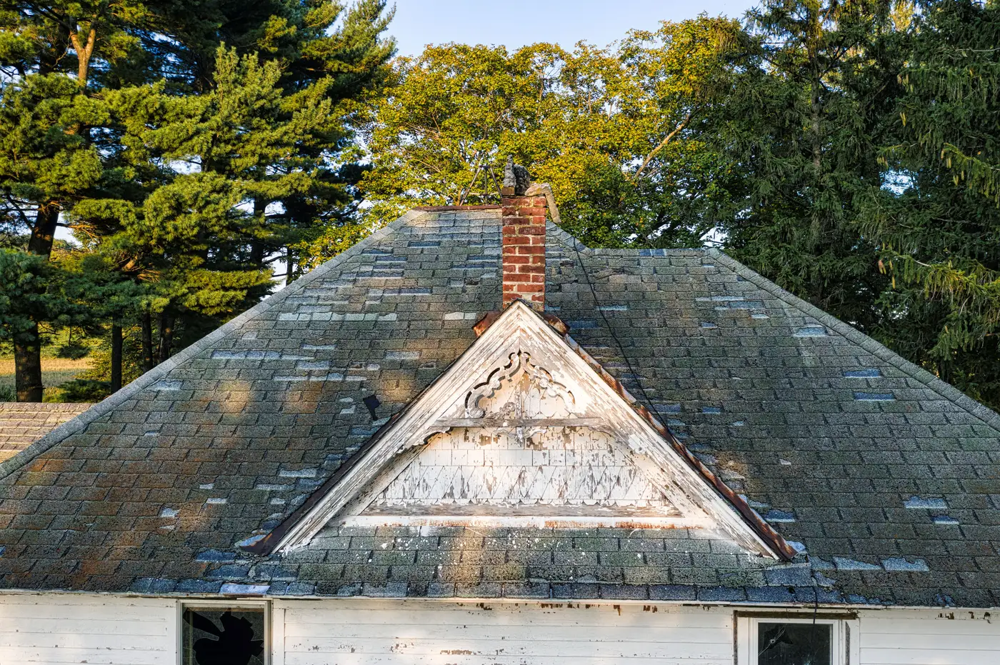
Every cat team lead has had this file: a roof that looks beat up in the imagery, an adjuster who wants to know if it's the storm or just an old roof that was already on borrowed time. Get it wrong in either direction and you're either over-reserving a claim that's mostly pre-existing condition, or sending a truck past a building that needs one. Here's what to look for before you make that call.
Wear builds over years, damage shows up overnight
Pre-existing wear reads as even, gradual change across a slope. Granule loss from age tends to spread across the whole south- or west-facing side of a roof, the side that's taken the most sun over its life, rather than in a tight cluster. The exposed material underneath is the same weathered color as everything around it, because it's been losing granules slowly for years, not torn open last week. Curling tabs, algae streaking, moss at the eaves, a shingle course that's visibly a different generation than the rest of the roof: all of that sits there no matter what the wind did on the day of the event.
Wind damage from a specific storm looks different because it happens fast. Creased shingles bend back along a hinge line instead of lying flat. Torn tabs expose lighter, less-weathered substrate that stands out against the surrounding color, because it hasn't had time to oxidize to match. Debris strikes show up as small, sharp marks scattered with no relationship to slope orientation, often heaviest near trees or on the windward side of the building. Missing shingles cluster in patches that line up with the wind's path across the roof, not with where the sun hits hardest.
Match the pattern to the storm, not just the roof's age
The test that matters for a reserve decision isn't "does this roof look rough." It's whether the damage pattern lines up with the wind field that passed over that specific address. If the worst-looking material is on the leeward side, or it's scattered evenly across every slope regardless of orientation, that's a sign you're looking at age and weathering rather than this event, and it's worth a note for the adjuster rather than an automatic bump to the reserve. If you've got a pre-storm image in the file for comparison, even a rough one, line the two up side by side before you write anything down. A fresh tear line that wasn't there a month ago tells you something an aged, uniform wear pattern never will.
None of this replaces a licensed adjuster standing on the roof with a probe and a tape measure. What it does is tell you which buildings are worth sending that adjuster to first, and which ones in the footprint can probably wait. That's the gap Windstorm Damage is built to close: a per-building damage grade across your whole storm footprint within days of the event, pulled from very-high-resolution satellite or aerial imagery, so reserves and deployment decisions don't have to wait on drive-by surveys or whatever photos a policyholder happened to text in.
A few things to check before you write the estimate
- Compare color, not just shape. Fresh damage exposes lighter material. Old wear is uniformly dull across the whole patch.
- Check the direction. Storm damage follows the wind field. Age-related wear follows the sun and the slope.
- Look at the neighbors. If every roof on the block built in the same decade shows the same granule loss pattern regardless of which way it faces, that's wear, not wind.
- Flag, don't assume. Ambiguous cases still need an adjuster's eyes. The imagery tells you where to send them first, not how to close the file.
Getting this distinction right at the triage stage saves adjusters from driving out to roofs that were already failing before the storm hit, and keeps reserves closer to what the event caused. If you're coordinating deployment across a storm footprint and want that triage done from imagery instead of a windshield, that's the whole point of the tool.